INTRODUCTION


Drones have been around for years and they
are used for different purposes and can be of help in numerous occasions.
However, these devices have become more popular in recent times and their
application increases rapidly in various fields. But first of all let's answer
the main question: "What is a drone and how we can define it?"
The word ‘drones' has several different
meanings and it origins from old English word darn, which means 'male
bee'. Drone is an aircraft that does not
have a pilot but is controlled by someone on the ground, used especially for
dropping bombs or for surveillance. Drones are more formally known as unmanned
aerial vehicles (UAVs) or unmanned aircraft systems (UASes). Essentially, a
drone is a flying robot. The aircrafts may be remotely controlled or can fly
autonomously through software-controlled flight plans in their embedded systems
working in conjunction with onboard sensors and GPS.
Physics behind the drone: Drones uses
rotors for propulsion and control. We can think rotor as a fan. If you observe
drone, you will find that each drone consist of four rotors. The spinning
blades push the air, down. Of course, all the forces come in pair, which means
that as the rotor pushes down on the air, the air pushes up the rotor. This is
the basic idea behind lift, which comes down to controlling the upward and
downward force. The faster the rotor spins, the greater is the Lift, and
vice-versa. For a drone to hover, the net thrust of the four rotors pushing the
drone must be equal to the gravitational force pulling it down. For the
descending of the drone, the process is exactly opposite: i.e, simply
decreasing the rotor thrust (speed) so the net force is downward. 
Uses have included remote sensing for
Earth Sciences studies, hyper spectral imaging’s for agriculture monitoring,
tracking of severe storms and serving as telecommunications relay platforms.
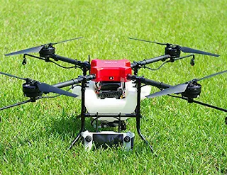
An agricultural drone is an unmanned
aerial vehicle applied to farming in order to help increase crop production and
monitor crop growth. Sensors and digital imaging capabilities can give farmers
a richer picture of their fields. Thus, these views can assist in assessing
crop growth and production. Some of the main applications are given below:

AERIAL
PHOTOGRAPHY
Drones are now being used to capture footage that would otherwise require
expensive helicopters and cranes. Fast paced action and sci-fi scenes are
filmed by aerial drones, thus making cinematography easier. These autonomous
flying devices are also used in real estate and sports photography.
Furthermore, journalists are considering the use of drones for collecting
footage and information in live broadcasts.
SHIPPING AND DELIVERY
Major companies like Amazon, UPS, and DHL are in favor of drone delivery.
Drones could save a lot of manpower and shift unnecessary road traffic to the
sky. Besides, they can be used over smaller distances to deliver small
packages, food, letters, medicines, beverages and the like.

GEOGRAPHIC MAPPING

SUBMITTED BY:
Available to amateurs and professionals, drones can acquire very
high-resolution data and download imagery in difficult to reach locations like
coastlines, mountaintops, and islands. They are also used to create 3D maps and
contribute to crowd sourced mapping applications.
DISASTER MANAGEMENT
Drones provide quick means, after a natural or man-made disaster, to gather
information and navigate debris and rubble to look for injured victims. Its
high definition cameras, sensors, and radars give rescue teams access to a higher
field of view, saving the need to spend resources on manned helicopters. Where
larger aerial vehicles would prove perilous or inefficient, drones, thanks to
their small size, are able to provide a close-up view of areas.
PRECISION AGRICULTURE
Farmers and agriculturists are always looking for cheap and effective
methods to regularly monitor their crops. The infrared sensors in drones can be
tuned to detect crop health, enabling farmers to react and improve crop
conditions locally, with inputs of fertilizer or insecticides. It also improves
management and effectuates better yield of the crops.
SEARCH AND RESCUE
Presence of thermal sensors gives drones night vision and makes them a
powerful tool for surveillance. Drones are able to discover the location of
lost persons and unfortunate victims, especially in harsh conditions or
challenging terrains. Besides locating victims, a drone can drop supplies to
unreachable locations in war torn or disaster stricken countries. For example,
a drone can be utilized to lower a walkie-talkie, GPS locator, medicines, food
supplies, clothes, and water to stranded victims before rescue crews can move
them to some place else.
WEATHER FORECAST
Drones are being developed to monitor dangerous and unpredictable weather.
Since they are cheap and unmanned, drones can be sent into hurricanes and tornadoes, so that scientists and weather forecasters acquire
new insights into their behavior and trajectory. Its specialized sensors can be
used to detail weather parameters, collect data, and prevent mishaps.
WILDLIFE MONITORING
Drones have served as a deterrent to poachers. They provide unprecedented
protection to animals, like elephants, rhinos, and big cats, a favorite target
for poachers. With its thermal cameras and sensors, drones have the ability to
operate during the night. This enables them to monitor and research on wildlife
without causing any disturbance and provides insight on their patterns, behavior,
and habitat.
LAW ENFORCEMENT
Drones are also used for maintaining the law. They help with the
surveillance of large crowds and ensure public safety. They assist in
monitoring criminal and illegal activities. In fact, fire investigations, smugglers
of migrants, and illegal transportation of drugs via coastlines, are monitored
by the border patrol with the help of drones.

SUBMITTED BY:
Thushara R B
Yogini E
Pradeep A
Sahana D
TELL ME WHY (monthly)
en.wikipedia.org/wiki/Unmanned_aerial_vehicle
https://www.allerin.com